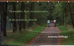
Algemeene Land- en Zeekaart van de Nederlandsche overzeesche bezittingen met het Koninkrijk der Nederlanden in Europa naar de beste en nieuwste bronnen onder deskundig toezigt … krachtig instrument : de Koninklijke Marechaussee 1814-2014 / Herman Roozenbeek, Jeoffrey van Woensel, Frank Bethlehem ; cartografie: Louis Kaulartz Bosatlas van het cultureel erfgoed / redactie: Noordhoff Atlasproducties ; de begeleidende teksten zijn geschreven door: drs. E. Beukers, drs. L. Coffeng, drs. G. Renting. … Tome Second. Oude lijnen in het Utrechts landschap : 16 wandel-, fiets- en kanoroutes in de provincie Utrecht / Lourens Vellinga ; [cartogr. Buijten & Schipperheijn Cartografie, … Lijst van gedrukte kaarten, voorhanden in het Archief der genie van het Ministerie van Oorlog Nederlandsche luchtkarteering in Nieuw Guinea / R.N. De Ruyter van Steveninck Signalling and map-reading for the home-guard : with advice on improvising equipment / H.G. Stokes Aanwijzing bij het topographische teekenen en het lezen van gedrukte kaarten : atlas van 24 platen met inhoud en 1 bijvoegsel / M.H.A.J. van Meurs … Lehre der Situation-Zeichnung oder Anweisung zum richtigen Erkennen und genauen Abbilden der Erd-Oberfläche, in Charten und Planen / von Johann George Lehmann; hrsg. und mit … Manual of map reading, photo reading, and field sketching, 1929 / The War Office - Engeland Voorschrift, 26/GS Pubns/124 Elementry map and aerial photography reading - USA Voorschrift, Field Manual