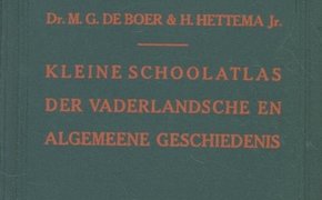
Nelson's war atlas Andrees allgemeiner Handatlas in 139 Haupt- und 161 Nebenkarten nebst vollständigem alphabetischem Namenverzeichnis special publication Atlas de Filipinas : colección de 30 mapas / trabajados por delineantes filipinos bajo la dirección de José Algué Campagne de 1815 : Waterloo / Charras : Atlas spéciale Gemeente-atlas van Nederland : schaal 1 : 200.000 : aangevende de grenzen, grootte en bevolking der gemeenten / door W.J. Geerling mededeelingen van het centraal kantoor voor de statistiek Landbouwatlas van Java en Madoera = Agricultural atlas of Java and Madura Karte zur Schlacht bei Tannenberg / v. Schäfer ; mit einem Geleitwort des Generalfeldmarschalls v. Hindenburg Carte de l'Europe à l'échelle de 1 : 4.000.000 : dressée et publiée par le service géographique de l'armée : frontières à la date du … northern countries in world economy : Denmark, Finland, Iceland, Norway, Sweden / publ. by the Delegation for the Promotion of Economic Cooperation between the Northern … Atlas van Nederland = Atlas of the Netherlands / samengest. door Stichting Wetenschappelijke Atlas van Nederland Kleine schoolatlas der vaderlandse en algemene geschiedenis / door M.G. de Boer en H. Hettema Times atlas of the world : comprehensive edition / prod. and publ. by The Times in collab. with John Bartholomew and Son Ltd., Edinburgh