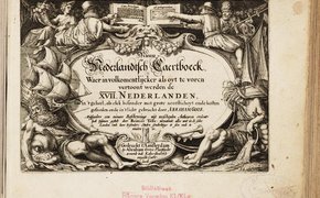
Atlas historique, généalogique, chronologique et géographique / de A. Le Sage (Comte de Las Cases) ; avec des augmentations par J. Marchal, ... ; et … Schlachten-Atlas des neunzehnten Jahrhunderts, vom Jahre 1828 bis 1885 : Pläne aller wichtigeren Schlachten, Gefechte, Treffen und Belagerungen in Europa, Asien und Amerika, mit Kartenskizzen … Schlachten-Atlas des neunzehnten Jahrhunderts, vom Jahre 1828 bis 1885 : Pläne aller wichtigeren Schlachten, Gefechte, Treffen und Belagerungen in Europa, Asien und Amerika, mit Kartenskizzen … Gemeentenatlas Benelux = Atlas des communes / samengest. door De Rijksdienst voor het Nationale Plan in Nederland in samenwerking met het Hoofdbestuur van de Stedebouw … Nieuw Nederlandtsch Caertboeck. Waer in volkomentlijcker als oyt te voren vertoont werden de XVII. Nederlanden, soo in 't geheel, als elck besonder met grote neersticheyt … Atlas topographique et militaire pour servir a l'intelligence de la campagne d'Italie en 1859 avec légendes explicatieves / par Vandevelde Historische atlas van Noord-Nederland van de XVI eeuw tot op heden / door G. Mees Azn Autowegen-atlas Java Madoera Bali Royal Gunpowder Factory, Waltham Abbey : plans and illustrations / Royal Commission on the Historical Monuments of England Atlas universel de géographie physique, politique, statistique et minéralogique / sur l'échelle de 1/1641836 ou d'une ligne par 1900 toises dressé par Ph. Vandermaelen, d'après … hes studies in the history of cartography and scientific instruments oldest maps of the Netherlands : an illustrated and annotated carto-bibliography of the 16th century maps of the XVII Provinces / H.A.M. van der Heijden Historische atlas van Noord-Nederland van de XVIde eeuw tot op de scheiding van België / door G. Mees Az